Log in
All resources
Create a design
633 Free Artworks of General Maps
general atlas (1773)
russian empire in thomas kitchen's general atlas (1773)
maps by jean-baptiste bourguignon d'anville
oil on canvas
guillaume sanson
maps in the library of congress
maps made in the 17th century
bibliothèque nationale de france
1665 maps
1665 maps of ukraine
william i of the netherlands (joseph paelinck - rijksmuseum amsterdam)
1819 portrait paintings of men
maps of the persian gulf
james justinian morier
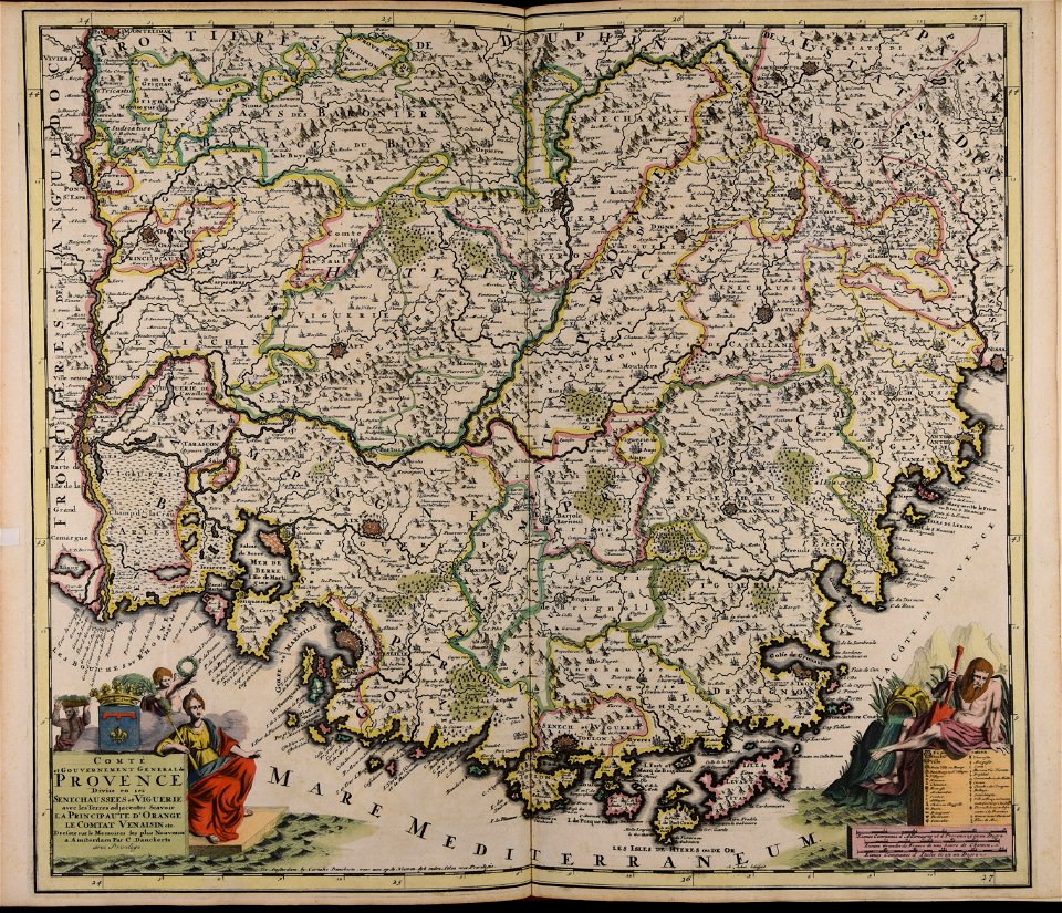
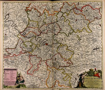
administrative history of france
turgot map of paris
landscape
maps
english-language maps
1814 maps
list of paintings and plots by pascal coste and eugène flandin
isfahan
1712 maps of puerto rico
johannes van keulen
australia
maps
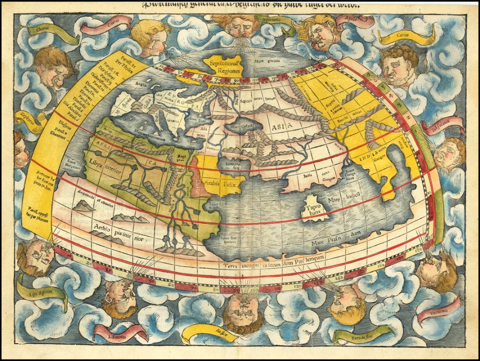
maps by sebastian münster
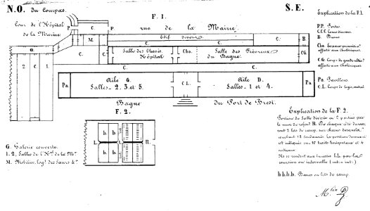
bagne de brest
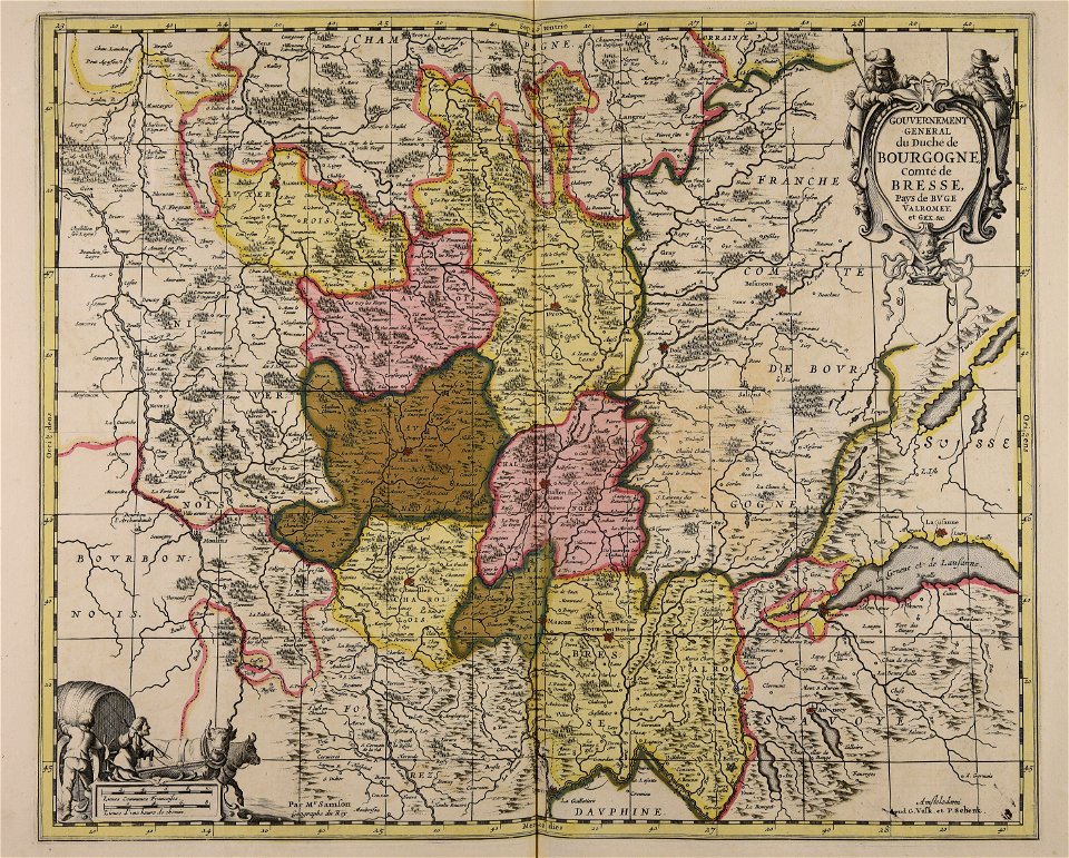
france
maps in the library of congress
old maps of massachusetts
maps in the library of congress
old maps of massachusetts
maps in the library of congress
old maps of massachusetts
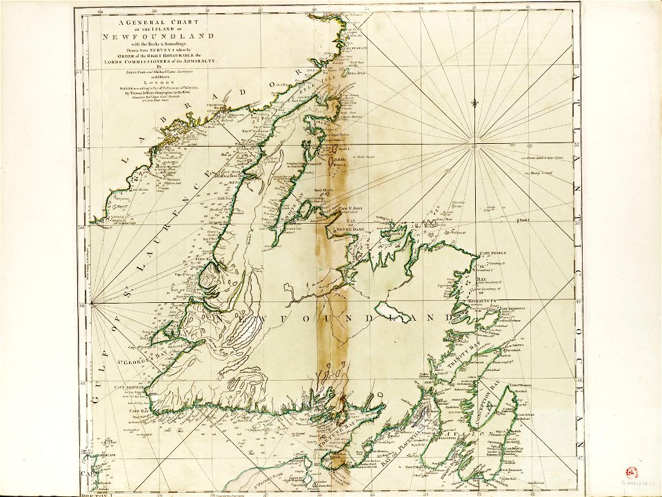
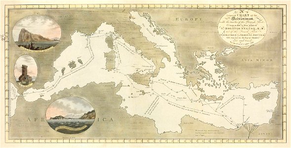
charts and maps of the royal museums greenwich
james cook (maps relating to)
maps made in the 17th century
cornelis danckerts (i)
maps made in the 17th century
jan janssonius
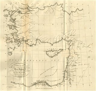
old maps of greece
old maps of turkey
maps of battles of the netherlands
hugh mackay (general)
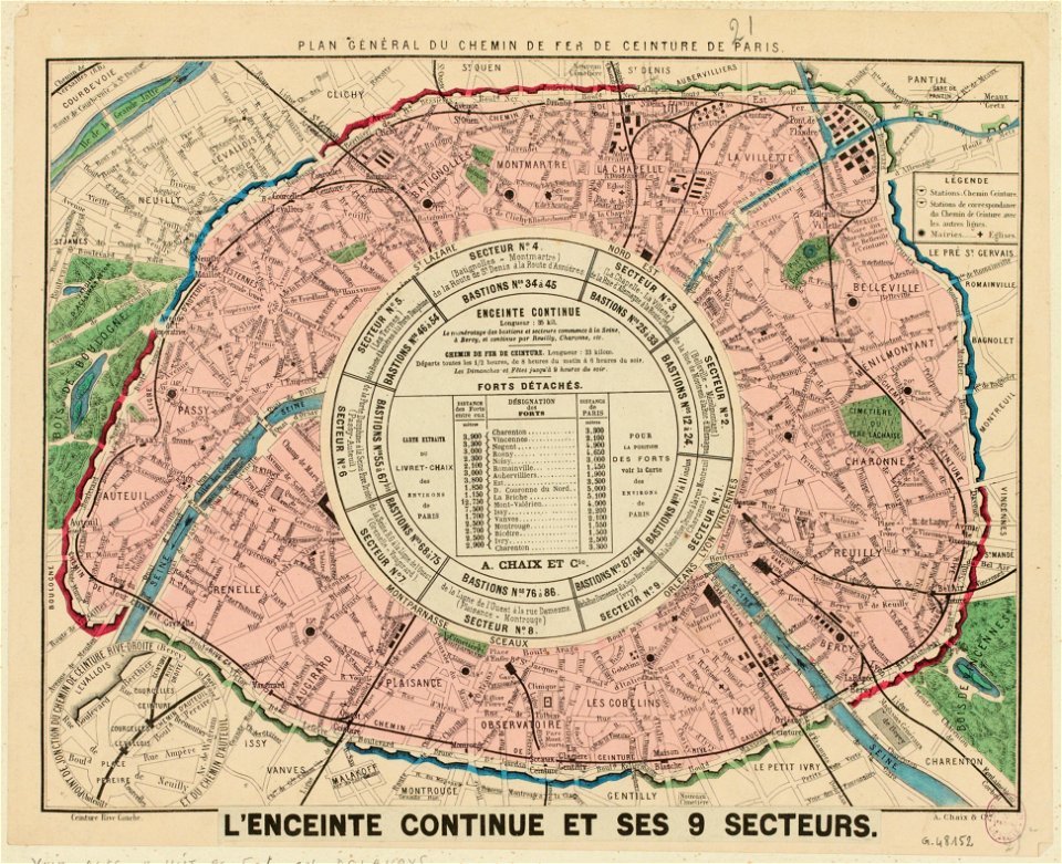
maps of paris from paris musées
rail transport maps of paris
asia and africa
1813 maps
drawings of soldiers
jan anthonie coxie
maps made in the 17th century
cornelis danckerts (i)
earth
maps
historical images of orléans
maps with cartouches
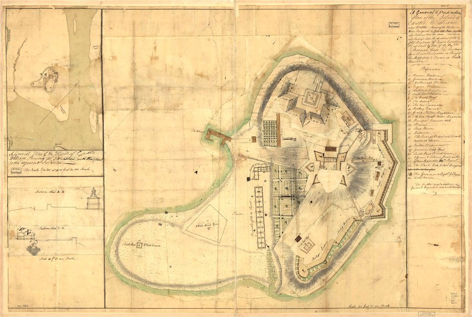
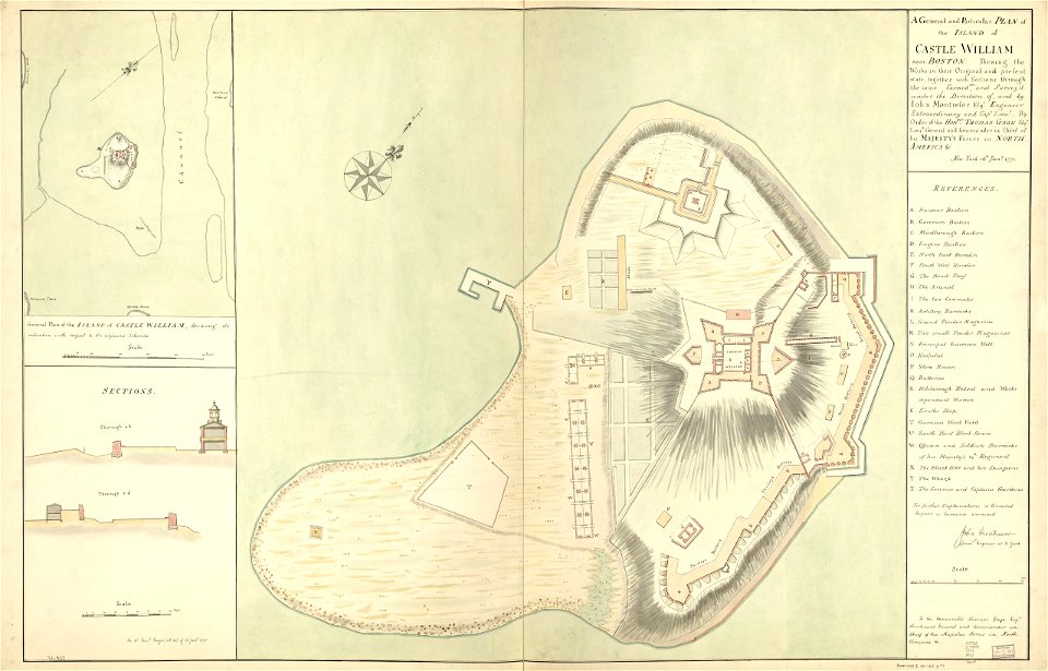
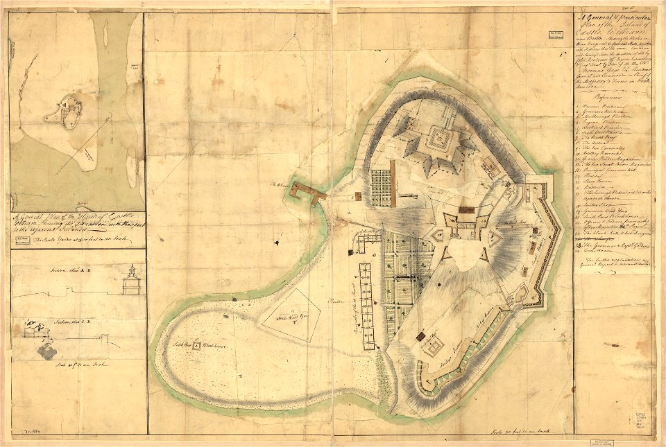
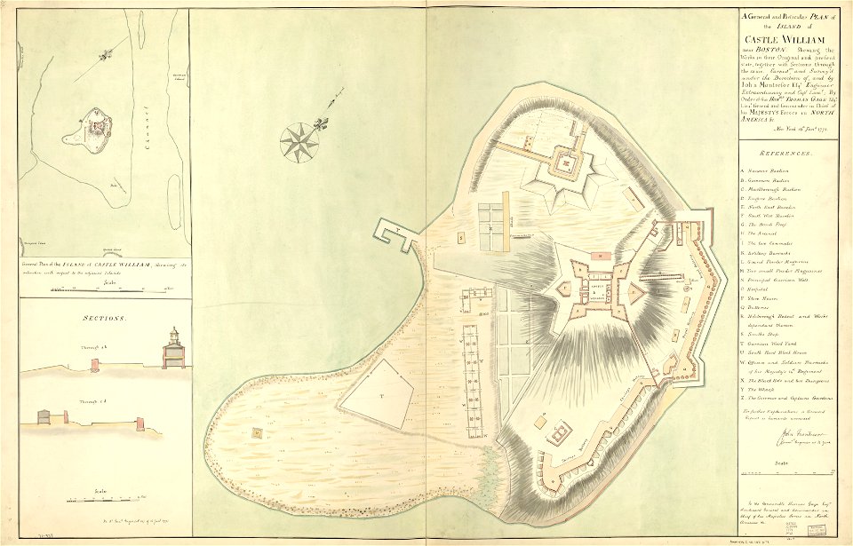
fort independence (massachusetts)
maps in the library of congress
maps made in the 17th century
gerard valck
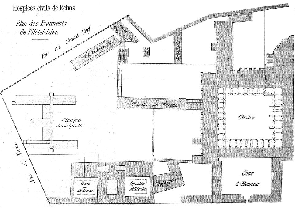
bibliothèque municipale de reims
abbey of saint-remi
printing
london
rosenborg castle
kongens have
1776
1777
artworks with known accession number
artworks without wikidata item
portrait paintings of men by george romney
rococo
old constellation maps
maps by samuel dunn
british east india company
london
old maps of the american revolution
conflicts in 1778
carel herman aart van der wijck
louis storm van 's-gravensande
architectural drawings of luxembourg palace
maps of jardin du luxembourg
portrait paintings with natural background
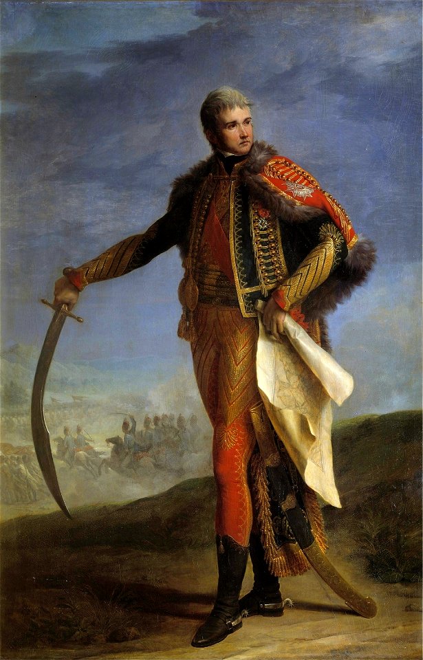
jean lannes
russian empire in thomas kitchen's general atlas (1773)
general atlas (1773)
maps in the library of congress
adriaen van der donck
bird's-eye views of paris
1860 in paris
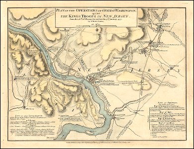
a plan of the operations of the king's army under the command of general sr. william howe, k.b. in new york and east new jersey, against the american forces commanded by general washington, from the 12th. of october, to the 28th. of november 1776
old maps of new york (state) from the norman b. leventhal map center
1474 maps
1928 maps
maps of argyre quadrangle
mars topography
turgot map of paris, norman b. leventhal map center
key sheet of the turgot map of paris
russian empire in thomas kitchen's general atlas (1773)
general atlas (1773)
russian empire in thomas kitchen's general atlas (1773)
general atlas (1773)
john rocque's 1746 map of london
details of old maps of london
russian empire in thomas kitchen's general atlas (1773)
general atlas (1773)
19th-century portrait paintings in the musée de l'armée
nicolas gosse
atlas van der hagen (volume 4)
atlas van der hagen
bird's-eye views of paris
1860 in paris
general atlas (1773)
old maps of sakhalin
russian empire in thomas kitchen's general atlas (1773)
general atlas (1773)
southwark, philadelphia
sparks shot tower
19th-century portrait paintings in the musée national du château de versailles
jean charles nicaise perrin
a plan of the operations of the king's army under the command of general sr. william howe, k.b. in new york and east new jersey, against the american forces commanded by general washington, from the 12th. of october, to the 28th. of november 1776
battle of white plains
maps by edward wright
molyneux globes
old maps of manchuria
general atlas (1773)
maps of paris from bibliothèque nationale de france
maps of paris by alexis-hubert jaillot
1777 maps of new york (state)
1777 maps of new jersey
maps with figures
michael burghers
a voyage to abyssinia, and travels into the interior of that country, executed under the orders of the british government in the years 1809 & 1810
john outhett
maps of paris from bibliothèque nationale de france
maps of paris by alexis-hubert jaillot
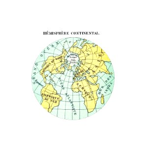
1800s maps of the world
old maps of the world
maps of paris from bibliothèque nationale de france
maps of paris by alexis-hubert jaillot
russian empire in thomas kitchen's general atlas (1773)
general atlas (1773)
old maps of french guiana
1630s maps of brazil
english-language maps
1747 maps of asia
carta hydrographica y chorographica de las yslas filipinas
baroque painting
1665 maps of ukraine
1665 maps
russian empire in thomas kitchen's general atlas (1773)
general atlas (1773)
a plan of the operations of the king's army under the command of general sr. william howe, k.b. in new york and east new jersey, against the american forces commanded by general washington, from the 12th. of october, to the 28th. of november 1776
iona island (new york)
maps by pieter mortier
1700 maps of africa
georges barthélemy médéric flamand
chotts
russian empire in thomas kitchen's general atlas (1773)
general atlas (1773)
eran laor cartographic collection
adolf eltzner
maps from the mechanical curator collection
australia (1873) by booth
eran laor cartographic collection
edward rooker
johann david schleuen
old maps of prussia
eran laor cartographic collection
louis-françois cassas
1665 maps of ukraine
1665 maps
1690s maps of france
old maps of orléans
1910s maps of bosnia and herzegovina
1910s maps of croatia
ignatius van der stock
1661 paintings
french-language maps
ambroise tardieu
mappe-monde geo-hydrographique (sanson and jaillot, 1674)
1665 maps of ukraine
1665 maps
old maps of montana
julius bien
maps by peter lesley
maps by james hall
17th-century maps of the malay archipelago
archipelagus orientalis
1665 maps of ukraine
1665 maps
confluence of the seine and marne rivers
plan de roussel - derivative files
manual of the corporation of the city of new york (1858)
battle of long island
too late for gordon and khartoum (1887) by macdonald
old maps of the nile
maps by jakob van der schley
old maps of kollam
maps of the island of korčula
gustav freytag (cartographer)
david rumsey historical map collection
1790s maps of the holy roman empire
1665 maps of ukraine
1665 maps
nouveau cours d'instruction primaire de géographie (1886)
1886 maps of france
1 - 100 of 633
Next page
/ 7